Mapped start 1,927 m
6–14 °C
Typical daily low–high in June
Bettmeralp · Valais
21.1 km27 June 2027
Choose a stage, then use the arrows to explore without leaving the map.
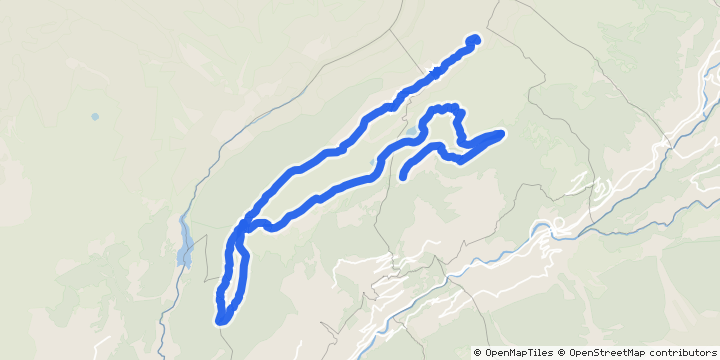 Bettmeralp · Valais
Course preview
Find your kind of race
Save uphill strength for the steep final two kilometres towards the 2,650 m finish. Distance alone understates this late effort. Connect the observed Moosfluh–finish timing leg with its map and profile to see how much of the race happens near the end.
2026: 23% of timed running was spent in the final published leg (mean finisher share).
Course and data sources ↓From Bettmeralp through Riederalp and along the ridge towards Bettmerhorn. The organizer describes a steep final two-kilometre climb to the finish at 2,650 m.
Two different mountain demands
57% has a mapped hiking grade; the pale remainder is unclassified.
Hiking grades describe paths. They are separate from running fitness and do not rate untagged stretches.
Cached accepted terrain profile; gradients use 100 m windows. Direction changes are at least 60° across 80 m, grouped within 100 m; these describe the line, not a count of junctions. Path grades come from the matched OpenStreetMap network. Organizer distance and height totals remain separate.
Official course source ↗4 sustained climbs · 502 m descending· 16.1 km above 2,000 m
Mapped kilometres · select a stage to explore its terrain and footing. Race splits below use the official 21.1 km distance.
Scenic stills from TrailSplits' 3D renderer. Explore the corresponding course section.
Rendered 3D terrain views. Organizer course map. These are landscape previews, not ground-level photographs.
Map data © OpenStreetMap contributors. Terrain and contours in Switzerland © swisstopo (swissALTI3D). Terrain and contours produced using Copernicus WorldDEM-30 © DLR e.V. 2010-2014 and © Airbus Defence and Space GmbH 2014-2018 provided under COPERNICUS by the European Union and ESA; all rights reserved.
The course in its landscape · captured 2026-10-26: © swisstopo (swisstopo-OGD).
Approaching the finish · captured 2026-10-26: © swisstopo (swisstopo-OGD).
swisstopo open-data terms ↗Official course source ↗Your mountain day
Use the field's actual times to choose a planning scenario, then inspect the main sections.
The chart shows historical finishers. Enter a target or choose a field time to add your scenario; the prefilled time is an example.
Overall women and men · 2,007 finishers. Time bins stay fixed to the overall field.
Classified overall women and men · 21.098 km · Historical edition of this distance; route and conditions may differ from the upcoming edition.
93% classified finishers · 2,007 of 2,157 published starters.
Choose a leg to see its map, profile, observed time band and your scenario. Timing-area boundaries may be approximate.
Bar widths average each finisher’s share of the published timed legs. Durations are observed medians and middle halves for all complete finishers. The published finish column and leg totals differ by a median 0 seconds; that clock difference is not assigned to running sections. Complete-leg coverage: 100%. Geographic actions use the reviewed reference line; support-area or place positions identify approximate timing areas, not surveyed timing mats.
Official 2026 leg times ↗Compare actual fields, then turn one familiar result into editable candidate scenarios.
Blue bands show actual fields. “Same place” applies the reference’s finishing position to each other field; fields contain different people. Effort scenarios use matched-person ratios where accepted, otherwise the existing gradient and distance model. Ranges show the middle half of matched ratios, or the stated pace-sensitivity range. Edit each target for your own day.
Aletsch Halbmarathon · 2026 official field ↗Course factors describe the accepted route. Historical times describe the people who finished that edition. The chart uses a complete classified finish list, with other distances and nonfinishers excluded; its time basis is shown above. Each edition stays separate. Source and correction receipts were checked 2026-10-24.
Official measurement, record eligibility and qualifier rules are separate organizer/federation facts; the course assessment is a practical PB or preparation guide.
The largest continuous climb gains 367 m over 2.4 km, at mapped km 18.3–20.7. Practise sustained uphill movement later in an outing, after an easier opening. Try a target below to see the time this climb occupies.
The longest continuous descent loses 124 m over 1.9 km, at mapped km 6.6–8.6. Include controlled downhill running in your preparation. Explore where the descent sits relative to the main climb.
The mapped course reaches 2,639 m. Look at the start and high-point race-month conditions below. Plan clothing for both, and use your section times to understand when you expect to be high on the course.
Course-specific preparation · mapped measurements use the reference route. Explore, compare and plan without an account.
Train to Bettmeralp Talstation, then cable car to the start at Bettmeralp.
From the Bettmerhorn finish, take the gondola down to Bettmeralp; allow time for the onward cable car.
Measured on our mapped course line, with heights smoothed along the line as route analysis does.
The climb that gains the most height. A climb rises at 3 % or more (read over 400 m), carries on through dips of less than 30 m and flatter stretches shorter than 1 km, and rises at least 50 m in all.
The descent that loses the most height, with its length and time beside it. A descent falls at 3 % or more (read over 400 m), carries on through rises of less than 30 m and flatter stretches shorter than 1 km, and falls at least 50 m in all.
The 1 km stretch that rises the most, anywhere on the course.
The 500 m stretch that rises the most, anywhere on the course. Short steeper pitches inside it are averaged in.
| Section | Where | Climb | Descent | Moving time |
|---|---|---|---|---|
| Between climbs | +59 m | −18 m | 8 % | |
| Climb | +128 m | −16 m | 10 % | |
| Between climbs | +11 m | −5 m | 1 % | |
| Descent | +3 m | −76 m | 5 % | |
| Between climbs | +44 m | −5 m | 4 % | |
| Descent | +14 m | −124 m | 7 % | |
| Between climbs | +10 m | −12 m | 1 % | |
| Climb | +168 m | −8 m | 9 % | |
| Between climbs | +1 m | −2 m | <1 % | |
| Descent | +38 m | −97 m | 9 % | |
| Between climbs | +26 m | −16 m | 2 % | |
| Climb | +345 m | −61 m | 24 % | |
| Descent | +1 m | −57 m | 3 % | |
| Climb | +367 m | −3 m | 18 % |
The sections cover the whole course once, so their climbs add up to 1,215 m. Moving time is shared out by the pace plan's effort model (a kilometre, plus one for every 100 m up and 300 m down); stops are not included. Between climbs: Flat or rolling ground between the climbs and descents: it may still hold rises or drops of less than 50 m, or stretches gentler than 3 %. Not a claim that it is easy underfoot.
Faded stretches are inferred from the type of path. Positions follow the matched network, scaled to the mapped course; a surface tag does not describe technical difficulty.
OpenStreetMap tags the surface on 60% of this route; the rest is classed by its road type, an estimate.
Calculated on our mapped reference, using the same course analysis as the Planner. Heights are smoothed before identifying climbs and descents. The organizer’s published race distance and climbing remain the headline facts above. Analysis checked 2026-10-23; map release osm_weekly_20261018_0206.
6 published intermediate support locations. Highlight: official km 0.0–5.6.
5.6 · 9 · 12 · 14.2 · 17.5 · 20 km. Offerings vary by station; consult the official table.
The selected clock changes your scenario and finish margin. It does not change your race entry or block allocation.
Published schedule source ↗Example plan · 2:30 elapsed from 10:00. Edit a value or keep this example to make a deliberate choice.
Hours:minutes, including stops. Choose your assigned start block; changing this plan does not change your entry.
These are the accepted plan visits; a named split or control does not necessarily offer aid. Stops stay inside your target elapsed time.
Target finish is 534 min before sunset. Open-horizon daylight in Europe/Zurich.
Course-based pacing · 2:30 moving + 0 min stops = 2:30 elapsed
Use your current 2:30 plan as the baseline. Change one decision and see its effect.
Extra time is added to the baseline; its original planned stops remain.
Moosfluh 11:59 · 106 min before closure
Finish 12:30 · 150 min before closure
Longest: about 34 min · official km 0.0–5.6
Uses the current accepted course's split engine. Terrain adjustments apply to classified climb/descent sections. Support locations follow published race kilometres, positioned proportionally on the mapped line. Times between support points exclude the stop at either end. This is an editable sensitivity experiment on your baseline.
Moosfluh control: planned arrival 11:59 · 106 min before the 13:45 closure.
| Checkpoint | Race km | Elapsed | Clock | Margin |
|---|---|---|---|---|
| Aid 5.6 km | 5.6 | 0:34 | 10:34 | — |
| Aid 9 km | 9.0 | 0:54 | 10:54 | — |
| Aid 12 km | 12.0 | 1:16 | 11:16 | — |
| Aid 14.2 km | 14.2 | 1:31 | 11:31 | — |
| Aid 17.5 km | 17.5 | 1:56 | 11:56 | — |
| Aid 20 km | 20.0 | 2:17 | 12:17 | — |
| Finish | 21.1 | 2:30 | 12:30 | +150 min |
Moving time uses the existing TrailSplits pace engine: distance, climbing and descending. Stops are added at the listed intermediate checkpoints and remain inside your elapsed target. Heat, altitude and underfoot conditions do not automatically change this target-time plan.
Official race distance 21.0975 km; mapped reference 20.73 km. Published kilometre points are positioned proportionally on that reference. The route profile retains mapped kilometres; the table retains official kilometre labels.
Sunset assumes an open horizon; mountains can shade a trail earlier. Margins use published finish/checkpoint limits where available; a blank margin means no applicable limit was accepted.
Organizer timing source · checked 2026-10-23 ↗Aletsch Halbmarathon · 21.1 km · 2:30 example · 10:00 start
Free, without registration. Your link includes the baseline, start, planned stops and pacing experiment; device saves stay in this browser.
Example: 2:30 elapsed from 10:00. Edit these assumptions to explore another race-day scenario.
9–18 °C
Typical hourly range · estimated at course heightBinn, 1,479 m · 10.5 km from reference location
Rain in 5% of sampled hours5–14 °C
Typical hourly range · estimated at course heightEggishorn, 2,892 m · 2.2 km from reference location
Historical hourly observations near this calendar date (±14 days), 2018–2025. The displayed range is the 10th–90th percentile, using at least 186 observed hours across six years. Temperature is adjusted by 6.5 °C per 1,000 m where course and station heights differ by at least 100 m; these are estimates at course height. Rain describes sampled station hours, not a race-day probability.
Source: MeteoSwiss · CC BY 4.0 ↗
Sunlight uses our terrain horizon and solar calculator with this plan's passage times. Clouds and trees are separate. Near-horizon stretches remain uncertain.
The race-day forecast appears here as the race enters the forecast window.
Start choices come from the accepted organizer schedule.
June · 27 Jun 2027
Local time · Europe/Zurich
6–14 °C
Typical daily low–high in June
2–9 °C
Typical daily low–high in June
TerraClimate 1991–2020 monthly averages ↗. Monthly averages on a 4 km grid, with temperatures corrected to each location’s height. Precipitation is the monthly total of rain and snow water equivalent. These are typical conditions, not the race-day forecast.
Sun times use our daylight calculator and an open horizon. Nearby mountains affect when direct sunlight reaches the trail.
Organizer course map. Locations and heights follow the mapped reference course.
Compared with Aletsch Halbmarathon · 3 matching courses in this ten-race collection.
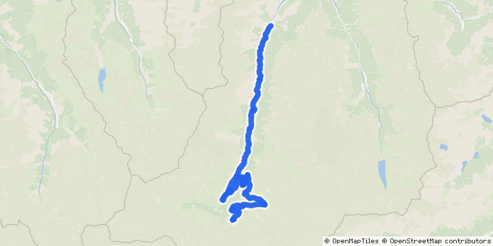 St. Niklaus → Riffelberg · Valais
42.2 km · a point-to-point course
42.2 km instead of 21.1 km
Compare these two →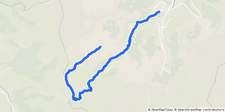 Adelboden → Sillerenbühl · Bern
12.6 km · about 313 m less mapped descending
12.6 km instead of 21.1 km · high point 2,033 m versus 2,639 m
Compare these two →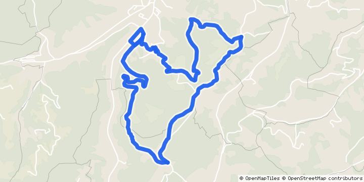 Krauchthal · Bern
13.0 km · high point 867 m
13.0 km instead of 21.1 km · high point 867 m versus 2,639 m
Compare these two →Use the course widget on your site, or send a correction with its official source. Organizer updates go through the existing verification and review process.
TrailSplits analyses an accepted organizer course reference using OpenStreetMap paths and terrain heights. Mapped distance and climbing can differ from the organizer’s measured totals. The course, timing and result references retain their own years; historical finish times describe that edition’s field. The published GPX is our matched reference.
The organizer’s facts table lists 1,148 m climbing and 432 m descending. Older profile prose on the same page says 1,050 m; the table is used here. The mapped terrain profile is a separate reference.
Official course sourceBeta training plan
The organizer-confirmed date and distance shape this generic plan. Vertical targets stay blank until course elevation is verified.
31 weeks and 3 days are available: enough for a full progression and taper.
Use it for race-effort sessions and race day. Easy runs stay easy whatever the goal; the plan's efforts come from how you run now.
The plan starts 5 April 2027, 20 weeks from now. Until then, easy running at your usual volume keeps you ready for week 1; the season planner can fill those weeks with base training.
Default starting point: 28 stable km/week, longest recent outing 13 km, 4 running days/week, aiming to finish well.
No connected training history is used. Unanswered details remain conservative assumptions.
No account needed. A kept plan stays on this browser until its storage is cleared; find it under My kept plans, where you can also change single weeks.
Choose a subscription that refreshes, or download a one-time copy.
Change only what you know. The preparation check and plan update immediately, without an account.
Still being enriched: course elevation or GPX. Future previews may use new evidence; kept copies remain unchanged.
Rest or gentle mobility.
40 min (about 4.9 km). Start with 10 minutes easy on rolling terrain. Then 6 x 20 seconds uphill strides, strong but relaxed, walking back down between them. Finish with at least 10 minutes easy; the rest of the run is easy on the hills.
Practise controlled climbing and recovery.
Use familiar, controllable downhill terrain; walking is valid. If descending is unfamiliar or leaves soreness, shorten it or choose easy running. Easy breathing does not establish low mechanical load.
70 min (about 8.5 km). Conversational aerobic running. Keep easy days easy enough to support the key work.
90 min (about 11 km). Build relaxed time on feet at conversational effort.
30 min (about 3.7 km). Use a flat, familiar route. Start with 5 to 10 minutes walking, within this outing, and check that your stride feels comfortable and normal. If movement feels normal, walk or jog very easily for up to 30 minutes in total. Finish earlier when that leaves you feeling better. Choose rest if soreness, heaviness or altered movement makes this unhelpful. The purpose is an easy recovery check after the long outing. Keep climbing and downhill practice for their own training sessions. Use how you feel today and tomorrow to guide the next session.
Rest or gentle mobility.
35 min (about 4.3 km). Start with 10 minutes easy on rolling terrain. Then 6 x 20 seconds uphill strides, strong but relaxed, walking back down between them. Finish with at least 10 minutes easy; the rest of the run is easy on the hills.
Practise controlled climbing and recovery.
Use familiar, controllable downhill terrain; walking is valid. If descending is unfamiliar or leaves soreness, shorten it or choose easy running. Easy breathing does not establish low mechanical load.
70 min (about 8.6 km). Conversational aerobic running. Keep easy days easy enough to support the key work.
90 min (about 11.1 km). Build relaxed time on feet at conversational effort.
40 min (about 4.9 km). Use a flat, familiar route. Start with 5 to 10 minutes walking, within this outing, and check that your stride feels comfortable and normal. If movement feels normal, walk or jog very easily for up to 40 minutes in total. Finish earlier when that leaves you feeling better. Choose rest if soreness, heaviness or altered movement makes this unhelpful. The purpose is an easy recovery check after the long outing. Keep climbing and downhill practice for their own training sessions. Use how you feel today and tomorrow to guide the next session.
Rest or gentle mobility.
40 min (about 4.8 km). Start with 10 minutes easy on rolling terrain. Then 6 x 20 seconds uphill strides, strong but relaxed, walking back down between them. Finish with at least 10 minutes easy; the rest of the run is easy on the hills.
Practise controlled climbing and recovery.
Use familiar, controllable downhill terrain; walking is valid. If descending is unfamiliar or leaves soreness, shorten it or choose easy running. Easy breathing does not establish low mechanical load.
70 min (about 8.5 km). Conversational aerobic running. Keep easy days easy enough to support the key work.
95 min (about 11.5 km). Build relaxed time on feet at conversational effort.
35 min (about 4.2 km). Use a flat, familiar route. Start with 5 to 10 minutes walking, within this outing, and check that your stride feels comfortable and normal. If movement feels normal, walk or jog very easily for up to 35 minutes in total. Finish earlier when that leaves you feeling better. Choose rest if soreness, heaviness or altered movement makes this unhelpful. The purpose is an easy recovery check after the long outing. Keep climbing and downhill practice for their own training sessions. Use how you feel today and tomorrow to guide the next session.
Rest or gentle mobility.
30 min (about 3.8 km). Start with 10 minutes easy. Then 6 x 20 seconds relaxed strides, with 1 minute easy between repeats. Finish with at least 10 minutes easy; any remaining time is easy.
Practise relaxed coordination.
60 min (about 7.5 km). Conversational aerobic running. Keep easy days easy enough to support the key work.
70 min (about 8.8 km). Build relaxed time on feet at conversational effort.
40 min (about 5 km). Use a flat, familiar route. Start with 5 to 10 minutes walking, within this outing, and check that your stride feels comfortable and normal. If movement feels normal, walk or jog very easily for up to 40 minutes in total. Finish earlier when that leaves you feeling better. Choose rest if soreness, heaviness or altered movement makes this unhelpful. The purpose is an easy recovery check after the long outing. Keep climbing and downhill practice for their own training sessions. Use how you feel today and tomorrow to guide the next session.
Rest or gentle mobility.
60 min (about 7.4 km). Climb at a conversational effort, power-hiking the steep parts, and descend with control. Time on hills, not a workout.
55 min (about 6.8 km). Conversational aerobic running. Keep easy days easy enough to support the key work.
100 min (about 12.4 km). Build relaxed time on feet at conversational effort.
35 min (about 4.3 km). Use a flat, familiar route. Start with 5 to 10 minutes walking, within this outing, and check that your stride feels comfortable and normal. If movement feels normal, walk or jog very easily for up to 35 minutes in total. Finish earlier when that leaves you feeling better. Choose rest if soreness, heaviness or altered movement makes this unhelpful. The purpose is an easy recovery check after the long outing. Keep climbing and downhill practice for their own training sessions. Use how you feel today and tomorrow to guide the next session.
Rest or gentle mobility.
60 min (about 7.2 km). Climb at a conversational effort, power-hiking the steep parts, and descend with control. Time on hills, not a workout.
60 min (about 7.2 km). Conversational aerobic running. Keep easy days easy enough to support the key work.
100 min (about 11.9 km). Build relaxed time on feet at conversational effort.
40 min (about 4.8 km). Use a flat, familiar route. Start with 5 to 10 minutes walking, within this outing, and check that your stride feels comfortable and normal. If movement feels normal, walk or jog very easily for up to 40 minutes in total. Finish earlier when that leaves you feeling better. Choose rest if soreness, heaviness or altered movement makes this unhelpful. The purpose is an easy recovery check after the long outing. Keep climbing and downhill practice for their own training sessions. Use how you feel today and tomorrow to guide the next session.
Rest or gentle mobility.
65 min (about 7.8 km). Climb at a conversational effort, power-hiking the steep parts, and descend with control. Time on hills, not a workout.
60 min (about 7.2 km). Conversational aerobic running. Keep easy days easy enough to support the key work.
105 min (about 12.7 km). Build relaxed time on feet at conversational effort.
35 min (about 4.2 km). Use a flat, familiar route. Start with 5 to 10 minutes walking, within this outing, and check that your stride feels comfortable and normal. If movement feels normal, walk or jog very easily for up to 35 minutes in total. Finish earlier when that leaves you feeling better. Choose rest if soreness, heaviness or altered movement makes this unhelpful. The purpose is an easy recovery check after the long outing. Keep climbing and downhill practice for their own training sessions. Use how you feel today and tomorrow to guide the next session.
Rest or gentle mobility.
35 min (about 4.3 km). Start with 10 minutes easy. Then 6 x 20 seconds relaxed strides, with 1 minute easy between repeats. Finish with at least 10 minutes easy; any remaining time is easy.
Practise relaxed coordination.
65 min (about 8 km). Conversational aerobic running. Keep easy days easy enough to support the key work.
80 min (about 9.8 km). Build relaxed time on feet at conversational effort.
40 min (about 4.9 km). Use a flat, familiar route. Start with 5 to 10 minutes walking, within this outing, and check that your stride feels comfortable and normal. If movement feels normal, walk or jog very easily for up to 40 minutes in total. Finish earlier when that leaves you feeling better. Choose rest if soreness, heaviness or altered movement makes this unhelpful. The purpose is an easy recovery check after the long outing. Keep climbing and downhill practice for their own training sessions. Use how you feel today and tomorrow to guide the next session.
Rest or gentle mobility.
60 min (about 7.2 km). Climb at a conversational effort, power-hiking the steep parts, and descend with control. Time on hills, not a workout.
65 min (about 7.8 km). Conversational aerobic running. Keep easy days easy enough to support the key work.
110 min (about 13.2 km). Use race-like terrain where practical, but keep the overall effort controlled.
40 min (about 4.8 km). Use a flat, familiar route. Start with 5 to 10 minutes walking, within this outing, and check that your stride feels comfortable and normal. If movement feels normal, walk or jog very easily for up to 40 minutes in total. Finish earlier when that leaves you feeling better. Choose rest if soreness, heaviness or altered movement makes this unhelpful. The purpose is an easy recovery check after the long outing. Keep climbing and downhill practice for their own training sessions. Use how you feel today and tomorrow to guide the next session.
Rest or gentle mobility.
65 min (about 7.9 km). Climb at a conversational effort, power-hiking the steep parts, and descend with control. Time on hills, not a workout.
65 min (about 7.9 km). Conversational aerobic running. Keep easy days easy enough to support the key work.
110 min (about 13.4 km). Use race-like terrain where practical, but keep the overall effort controlled.
40 min (about 4.9 km). Use a flat, familiar route. Start with 5 to 10 minutes walking, within this outing, and check that your stride feels comfortable and normal. If movement feels normal, walk or jog very easily for up to 40 minutes in total. Finish earlier when that leaves you feeling better. Choose rest if soreness, heaviness or altered movement makes this unhelpful. The purpose is an easy recovery check after the long outing. Keep climbing and downhill practice for their own training sessions. Use how you feel today and tomorrow to guide the next session.
Rest or gentle mobility.
30 min (about 3.6 km). Start with 10 minutes easy. Then 3 x 2 minutes at controlled race effort, with 1 minute easy between repeats. Finish with at least 10 minutes easy; any remaining time is easy.
Practise controlled climbing and recovery.
Use familiar, controllable downhill terrain; walking is valid. If descending is unfamiliar or leaves soreness, shorten it or choose easy running. Easy breathing does not establish low mechanical load.
40 min (about 4.9 km). Conversational aerobic running. Keep easy days easy enough to support the key work.
50 min (about 6.1 km). Keep this comfortable and finish with plenty in reserve.
20 min (about 2.4 km). Use a flat, familiar route. Start with 5 to 10 minutes walking, within this outing, and check that your stride feels comfortable and normal. If movement feels normal, walk or jog very easily for up to 20 minutes in total. Finish earlier when that leaves you feeling better. Choose rest if soreness, heaviness or altered movement makes this unhelpful. The purpose is an easy recovery check after the long outing. Keep climbing and downhill practice for their own training sessions. Use how you feel today and tomorrow to guide the next session.
35 min (about 4.2 km). Keep this short and conversational. The goal is freshness, not fitness.
35 min (about 4.2 km). Run conversationally. If already familiar, include a few relaxed strides with full recovery; otherwise stay easy.
20 min (about 2.4 km). Rest, or jog very easily if that reliably helps you feel better.
Run the 21.1 km as planned: start controlled and use the fuelling and kit rehearsed in training.